.JPG)
.JPG)
.JPG)
.JPG)
.JPG)
.JPG)
.JPG)
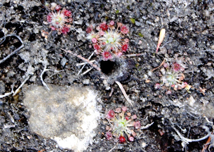
| Drosera pygmaea | Drosera pygmaea | |
 |
.JPG) |
|
| Description:Plants | Description:Plant | |
| Location:Waterfall Gully to Mt Lofty track, South Australia | Location:Lake St Clair,Tasmania | |
| GPS coordinates:34˚58.2888S, 138˚41.5457E | GPS coordinates:42˚06.996S, 146˚10.485E | |
| Date of photo:2 March 2010 | Date of photo:11 January 2010 | |
| Field No.:U237 | Field No.:U238 | |
| Drosera pygmaea | Drosera pygmaea | |
.JPG) |
.JPG) |
|
| Description:Plant | Description:Plants in habitat | |
| Location:Road to Strathgordon,Tasmania | Location:Road to Strathgordon,Tasmania | |
| GPS coordinates:42˚51.484S 145˚12.061E | GPS coordinates:42˚51.484S 145˚12.061E | |
| Date of photo:10 January 2013 | Date of photo:10 January 2013 | |
| Field No.:1871 | Field No.:1871 | |
| Drosera pygmaea | Drosera pygmaea | |
.JPG) |
.JPG) |
|
| Description:Plants with scape | Description:Plant in flower | |
| Location:Road to Strathgordon,Tasmania | Location:Road to Strathgordon,Tasmania | |
| GPS coordinates:42˚51.484S 145˚12.061E | GPS coordinates:42˚51.484S 145˚12.061E | |
| Date of photo:10 January 2013 | Date of photo:10 January 2013 | |
| Field No.:1871 | Field No.:1871 | |
| Drosera pygmaea | Drosera pygmaea | |
.JPG) |
.JPG) |
|
| Description:Plant in flower | Description:Plants in flower | |
| Location:Road to Scott's Peak Dam,Tasmania | Location:Mt Field,Tasmania | |
| GPS coordinates:42˚53.009S 146˚22.918E | GPS coordinates:42˚40.952S 146˚36.949E | |
| Date of photo:6 January 2016 | Date of photo:10 January 2013 | |
| Field No.:3817 | Field No.:3800 | |
References (accessed 10 June 2017):
http://www.utas.edu.au/dicotkey/dicotkey/CARYOPH/sDrosera_pygmaea.htm
Image use policy 
This work is licensed under a
Creative Commons Attribution-Noncommercial 2.5 Australia License.
Page created 23 August 2010
Page edited 10 June 2017
© Roger Fryer and Jill Newland 2010 - 2017